


SityTrail hiking trail GPS
Опис програми SityTrail hiking trail GPS
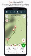
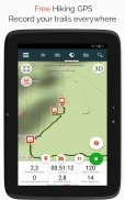
Ідіть і відкривайте всі стежки світу
• Записуйте маршрути під час зйомки HD та геотегованих фотографій своїх пригод.
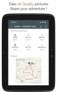
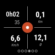
• Пройдена відстань, зусилля в кілометрах, середня швидкість, спалені калорії тощо.
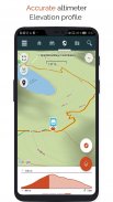
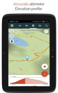
• Точний висотомір, обчислення різниці висот і профіль висоти, що відображає ваше поточне місцезнаходження.
• Сигналізація, коли ви збиваєтеся зі шляху слідування. Більше не потрібно повертатися назад!
• Автоматичний запуск визначних місць із перетворенням тексту в мовлення.
• Створіть безкоштовний обліковий запис, і всі ваші дані будуть доступні всюди на кожному пристрої.
• Легке створення маршрутів і визначних місць на нашому веб-сайті.
• За допомогою нашого онлайн-редактора створюйте власні траси за допомогою веб-браузера на ПК/Mac, а потім отримуйте доступ до них безпосередньо зі свого смартфона, щоб випробувати їх на землі.
• Сортуйте та класифікуйте маршрути та цікаві місця у власних списках.
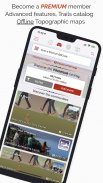
Ідіть далі та станьте ПРЕМІУМ-користувачем!
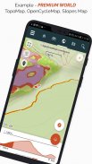
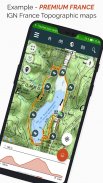
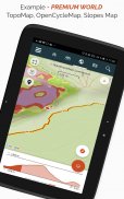
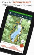
• Завантажуйте топографічні карти світу для використання в автономному режимі.
• Відкрийте для себе пішохідні стежки GR, європейські пішохідні маршрути, маршрути Сантьяго-де-Компостела для паломників тощо.
• Додайте топографічні карти за вашим вибором від IGN Франції, IGN / NGI Бельгії, IGN Іспанії, swisstopo, Австрії, США (топографічні карти USGS), Канади (Toporama).
• Ви також можете відкрити для себе всі велосипедні мережі: мережа Greenway у Франції, Равель у Бельгії, європейські велосипедні маршрути, мережі вузлів у Фландрії та Нідерландах.
• А взимку відкрийте для себе всі гірськолижні траси з їх назвами.
• Доступ до загальнодоступного каталогу маршрутів від учасників і спільнот SityTrail.
• Розширені функції відстеження та наведення з розрахунком відстані та часу, що залишився, а також голосові вказівки на перехрестях.
• Перетворіть свої улюблені маршрути на справжні мультимедійні путівники з текстом, фотографіями, посиланнями на відео та поділіться ними зі спільнотою SityTrail.
• Створюйте власні туристичні спільноти та керуйте своїми учасниками та стрічками новин.
• Створюйте стежки за допомогою наших розширених функцій для редагування трас через наш веб-сайт.
• Друк слідів у форматі PDF із QR-кодами. (А4, А3).
• Доступ до статей Вікіпедії з геотегами з нашого модуля SityTrip.
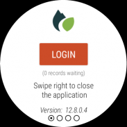
Запишіть трейл на свій годинник Wear OS
Ви можете записувати трейл на свій годинник Wear OS в автономному режимі (не підключений до смартфону Android) або в сполученому режимі (підключений до смартфону Android).
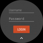
Додаток також дозволяє увійти до наявного облікового запису SityTrail (з екрану, який знаходиться ліворуч), коли годинник використовується в автономному режимі.
Важлива інформація
• Деякі функції потребують підключення до Інтернету.
• Тривале використання GPS може знизити рівень заряду акумулятора.
SityTrail hiking trail GPS – Версія 12.15.8.3
(24-06-2025)SityTrail hiking trail GPS - інформація про APK
Версія APK: 12.15.8.3ID пакета: com.geolivesОстання версія SityTrail hiking trail GPS
Інші версії


Додатки в цій категорії


Вам також може сподобатися...


